The length of the Williams River runs between the heights of the Barrington Tops and the wide lowlands of the Hunter Valley. The valley has many fertile but small river flats and is divided from the Allyn and Paterson Rivers to the west by rough hills of medium height.[1] The nearest settlement to the head of the Williams Valley is at Salisbury from which the river passes through a section of slopes and narrow floodplains until it is joined by its major tributary, the Chichester, at Bandon Grove. After this point the floodplains are wider and more continuous, passing through Dungog, becoming navigable at Clarence Town and joining the Hunter at Raymond Terrace, at which point it is actually the wider of the two streams.
The pre-European landscape was described as heavily timbered along the rivers with open grassy forest or ‘open forest land’ behind. While many trees have been cleared by European settlers, the hills were perhaps originally more wooded, though parts may have been kept cleared along the travel routes of the Gringai people, while areas protected by fire contained more extensive stands of rainforest. Cedar and other timbers were cut within easy reach of the rivers in the early settlement period. Pockets of native growth remain, and in recent times tree re-growth has again covered many of the hills.
The Barrington Tops to the north is a declared World Heritage area and encompasses spectacular rainforest and alpine environments. This includes the southernmost remnants of the Antarctic Beech (Nothofagus moorei). Further down the valley the most significant natural feature and considered by some to be of comparable world heritage value is Pilcher’s Mountain just a few kilometres from Dungog town. ‘Pilcher’s is on a plane far above, far above, anything else that is remnant vegetation.’ It is ‘absolute world heritage’.[2] Formed by tectonic stresses, Pilcher’s Mountain is a maze of massive boulders and niche environments containing numerous unique plant species.[3]
Known to local residents from at least the 1860s and no doubt earlier, the area of Pilcher’s Mountain was formed into a Crown reserve in 1889.[4] Little is known about activities, if any, after that (although numerous legends of bushranger treasure were told), until the 1960s and 1970s when cavers began to explore the area, including the Scouts Association. In the 1990s the Crown Reserve status was altered under Environmental Protection legislation and Dungog Shire Council is now responsible for a Management Plan of the area.[5] The fragile nature of this environment in addition to the potential danger to unguided tourists has led to the spectacular value of this area remaining relatively uninvestigated and unexploited to date.
All along the valley are numerous small pockets of surviving pre-European natural environment.[6] These are areas in ‘bits of the river today that still retain the atmosphere of the way it must have been 200 or 2,000 years ago’.[7] While these are more common in the higher ranges and within the boundaries of the Barrington Tops National Park, many such pockets are known to exist right along the entire length of the Williams at least as far as Clarence Town. A study from the 1990s of 46 dry rainforest stands (15 larger than 20 ha) within the Allyn, Paterson and Williams River valleys determined that 11 rainforest species (5 trees, 1 herb and 5 climbers) reach their southern limits within these valleys. This study also described the then conservation status of these stands as ‘unsatisfactory’.[8]
These pockets of native environment mostly exist where the river channel consists of cliffs and so cattle and other introduced species, including weeds, have been unable to penetrate, and where landowners have had little interest in going. Such pockets have been seen between Tillegra and Tunnibac, near Fosterton, and between Dungog and Clarence Town. More pockets exist on tributaries such as the Chichester below Wangat, which is very pure, with no weeds, and where nature has not been disturbed. Mulconda Creek further up the valley has steep sides along the stream containing gorges and caves. The cliffs above Fosterton are very rugged and retain a feeling of purity. Even on Dungog Common there exist ancient trees.
Perhaps the most significant of these pockets, and one with the potential to be restored, is that on a travelling stock reserve near Tillegra Bridge where less than a square kilometre of ‘grasses and other ground flora underneath ironbarks and spotted gums’ is to be found.[9] This pocket is however too isolated for animals, there are no bigger predators such as quolls, nor koalas, or ring-tailed possums as these last require hollows found only in older trees. However, this pocket of native environment is also very near one of the very few remaining ancient trees still standing outside the National Park boundaries. Near the Tillegra Bridge there is ‘an absolutely ancient falling to bits gum’, one that was ‘certainly there when the settlers arrived.’[10] This is a remarkable and rare survival that together with the nearby pocket of native plants represents a potential reserve.
The rainforest stands at Mirari Creek and Pilcher’s Mountain are considered to be particularly rich in species, and those at Pilcher’s Mountain have been recommended for preservation.[11] While most of these pockets preserve rare native plants species, they are generally too small to preserve native animals. One endangered species that does exist within the higher tributaries, such as Mulconda Creek and others which flow into the Williams River above Tillegra, is the Stuttering Frog (Mixophyes balbus).
In addition to the many areas of environmental significance within themselves, many elements of the natural environment of the Shire are of interest due to the history of human interaction. While little is known of what areas were of special significance to the Gringai people, the sites of some boras and other ceremonial areas have been catalogued.[12]
Water and water courses have perhaps done most to influence European settlement within the valley of the Williams. The many rivers, creeks, fords and punt crossings, as well as bridges, have played a major role in shaping not only the routes of roads but also the location of towns and schools. Clarence Town lies at the point where the depth of the river first begins to be impossible for boats, and Dungog then lies a good day’s walk up river from this point and Brookfield is mid-way between Clarence Town and Dungog. Bandon Grove is another good day’s walk up river from Dungog, while other settlements scattered around the district lie either up smaller valleys or higher up the main rivers at the edge of the Barringtons themselves.
The early prevalence of travel by foot and horse meant that many footpaths, bridle paths, as well as travelling stock routes have played a major role in movement within, as well as in and out of, the Williams Valley area. In contrast to the ‘dray roads’ which hugged the flats, footpaths and bridle paths would cross the ridges by shorter routes. A path from Gresford to Clarence Town, for example, would have cut across the ridges via Martin’s Creek. Little remains of such paths today. As to the bridle paths, many but not all are now roads. Examples of bridle paths not transformed into roads are those between Fosterton and Bandon Grove and from the end of Wordens Rd over to Hilldale.
The attractions of the relatively high rainfall of the upper reaches of the Williams Valley have also played a significant role within the valley in a unique sense. The attractions of the higher rainfall and hence water flows, coming off the Barrington Tops down into the Williams valley district were evident over 100 years ago when the Chichester Dam was proposed and built with minimum, if any protests on this tributary of the Williams River.[13] On the Williams itself the site at Tillegra is a potentially outstanding location for the building of a major dam, and the attraction of this rare feature from an engineering perspective along with the desire to utilise the water of the Williams River for the long-term needs of populations outside the valley has led to the perhaps unique situation of a specific location being proposed, protested against and withdrawn as a dam site on no less than three occasions within a little more than half a century.
Heritage on the Williams River
Antarctic Beeches
Tillegra native pocket
Tillegra ancient tree
Scattered pockets of native environment – dry rainforest
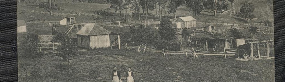
Oft proposed Tillegra Dam site
- Healthy Rivers Commission, Williams River Inquiry, p.9.↵
- Ken Rubeli, interviewed, 4/3/2012. See Note 6.↵
- Smith, ‘Tectonic and Talus Caves at Pilchers Mountain’, pp.11-20.↵
- For a report on a picnic here, see Maitland Mercury, 21/1/1865, p.5.↵
- Smith, Tectonic and Talus Caves at Pilchers Mountain, pp.16-17.↵
- Information on these surviving pockets comes supplied by Ken Rubeli, a local naturalist who has extensively surveyed the Williams River Valley and its tributaries. Interviewed, 4/3/2012.↵
- Ken Rubeli, interviewed, 4/3/2012.↵
- Turner & Vernon, Rainforest Stands between Barrington Tops and the Hunter River, p.465 & p.485.↵
- Ken Rubeli, interviewed, 4/3/2012.↵
- Ken Rubeli, interviewed, 4/3/2012.↵
- Turner & Vernon, Rainforest Stands between Barrington Tops and the Hunter River, p.485 & p.494.↵
- Hardy, Tillegra Dam Aboriginal Archaeology Environmental Assessment Report, pp.33-35.↵
- Healthy Rivers Commission, Williams River Inquiry, p.10.↵